Tulsa International Airport (TUL)
Orientation and Maps
(Tulsa, Oklahoma (OK), USA)
The city of Tulsa is the state's second-biggest city and has a population of around 390,000 inhabitants. Also the county seat, Tulsa is divided by the Arkansas River, which winds around the city center and passes many points of interest, such as the Westbank Soccer Complex, River West Festival Park, Newblock Park, Chandler Park and the River City Park.
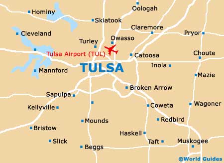
To the northeast of downtown Tulsa, the busy Tulsa International Airport (TUL) lies off Highway 11 and is easy to find. Those traveling by bus will arrive at the Greyhound station along South Detroit Avenue. Regular buses arrive at the station from many nearby cities, such as Oklahoma City, which has a journey time of around two hours.
Tulsa International Airport (TUL) Maps: Important City Districts
Downtown Tulsa is full of tall office blocks and striking buildings, with many superb restaurants and top shopping venues. Tulsa's downtown area is known for its art deco architecture, with highlights including the Union Depot and the imposing United Methodist Church.
The main tourist center is situated along South Boston Street and is the perfect place to find the latest visitor information and city maps. To the northeast of the city's downtown district is the Historic Greenwood District, which has become known for its cultural attractions and thriving arts scene. Other notable neighborhoods include Midtown Tulsa, where shopping opportunities are in good supply, and the Kendall-Whittier area, which is the city's most historic shopping district.
USA Map

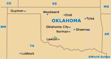
Oklahoma Map
Tulsa Map